
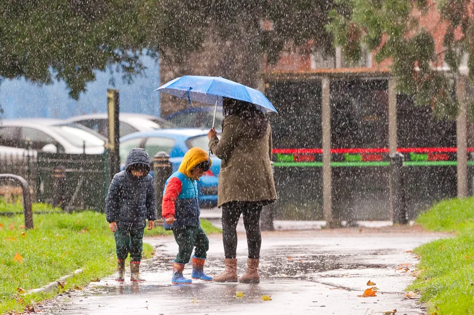
The UK is bracing for another spell of relentless wet weather as the Met Office issues three yellow warnings across large parts of the country, forecasting up to 18 hours of heavy rain and potential flooding. From southern England to the Scottish borders, forecasters warn that the latest band of rain could bring widespread travel disruption, power interruptions, and localized flooding in vulnerable areas.
The warnings come as part of an increasingly unsettled weather pattern that has marked the early days of November. According to meteorologists, a deep area of low pressure moving in from the Atlantic is responsible for pulling in moisture-laden air, which will trigger persistent rain showers and occasional heavy downpours through much of the day and night.
Heavy Rain Expected to Sweep the Country
The Met Office’s latest forecast suggests that rain will start intensifying early Tuesday morning, continuing well into the late hours of the evening. Areas most affected include Wales, the South West, and parts of Northern England, though forecasters have also warned of isolated heavy bursts reaching as far north as southern Scotland.
In total, rainfall accumulations could reach 40–60mm in many areas, with higher totals expected over hilly regions such as the Welsh mountains and the Pennines. Urban areas are expected to see surface water flooding, with some smaller rivers and streams potentially rising rapidly.
A yellow weather warning, the lowest tier in the Met Office’s alert system, still signifies significant potential for disruption. Motorists have been advised to exercise caution, with warnings of slippery roads and reduced visibility. Train services may also experience delays due to excess water on the tracks and potential signalling issues caused by the prolonged damp conditions.
Local Authorities on Alert
Local councils and emergency services are on standby across several counties. Flood response teams in Somerset, Devon, and Cumbria have already been briefed and equipped with sandbags, pumps, and road-clearing equipment in case conditions deteriorate further.
A spokesperson for a local council in the South West said:
“We’re monitoring river levels closely and coordinating with the Environment Agency to ensure communities are protected. Residents in flood-prone areas should remain alert and check flood warnings regularly.”
Meanwhile, the Environment Agency has also issued several flood alerts, particularly for low-lying and coastal regions. Riverbanks that are already saturated from recent rainfalls may struggle to contain additional water, increasing the risk of overflows and flash flooding.
Disruption to Daily Life
The heavy rain is expected to cause significant travel disruption, particularly during morning and evening commutes. National Highways has warned drivers to plan extra time for their journeys, keep headlights on during heavy rain, and avoid flooded routes. Bus and train networks are also preparing for potential service interruptions.
In some rural areas, power cuts may occur as strong winds accompany the rain, particularly in exposed coastal and hilly regions. The combination of high winds and wet ground could also lead to fallen trees, adding further risk for motorists and pedestrians alike.
Air travel could face minor delays as visibility worsens at major airports like Heathrow, Manchester, and Birmingham, though no significant cancellations are expected at this stage.
Farmers and Rural Communities on Edge
For farmers and rural residents, this weather system presents an additional challenge. Many parts of the country have already endured a wet autumn, and the continued rainfall could threaten newly planted crops and livestock conditions. Some agricultural experts have warned that waterlogged soil may reduce yields and delay fieldwork, especially for winter barley and wheat planting.
Livestock farmers are also being advised to check drainage systems and ensure animals have access to dry shelter. Fields and pastures could quickly become waterlogged, leading to poor grazing conditions.
Expert Insights: Why the Rain Keeps Coming
Meteorologists attribute the prolonged wet weather to a series of Atlantic weather fronts forming a “conveyor belt” of low-pressure systems moving eastward. This pattern is typical for this time of year, but the intensity and persistence of the rainfall are somewhat above average.
A senior meteorologist at the Met Office explained that while this system will bring widespread rain, it’s not uncommon in early November. However, what’s notable is the length of time some areas will be under continuous rainfall — up to 18 hours in parts of Wales and the Midlands.
Climate scientists have also suggested that such weather events could be exacerbated by broader climatic changes. Warmer air can hold more moisture, meaning storms are often able to release larger volumes of rain in shorter periods, increasing the likelihood of flash flooding.
Public Safety Advice
Officials are urging the public to take the warnings seriously and prepare accordingly. Those living in flood-prone areas should have emergency kits ready, including flashlights, bottled water, and essential medication. Homeowners are also being encouraged to secure outdoor furniture and garden equipment to prevent it from being swept away by strong winds.
Drivers have been told to slow down, maintain a safe distance from other vehicles, and avoid attempting to drive through standing water. As little as 30cm of moving water can float a small car, and road closures should be respected for safety reasons.
The Met Office also reminded residents to keep an eye on forecast updates, as warnings may be upgraded if conditions worsen overnight.
What Happens Next
The current spell of heavy rain is expected to move eastward by Wednesday morning, followed by a brief period of calmer weather. However, forecasters warn that another low-pressure system could bring more rain toward the end of the week.
While no severe weather warnings have been issued for later in the week yet, experts say the saturated ground means even moderate rain could cause further flooding issues.
In the longer term, the unsettled weather pattern is likely to persist throughout much of November, with above-average rainfall predicted for most regions. Temperatures, however, are expected to remain mild for the time being, offering some respite from early winter chills.
Conclusion
As the UK braces for 18 hours of relentless rain, residents are once again reminded of the unpredictable nature of British weather. While the yellow warnings may not signal an extreme event, the prolonged duration and widespread impact mean vigilance is essential.
From flooded streets to travel chaos, the next 24 hours will test the resilience of communities across the country. The silver lining, perhaps, is that forecasters expect calmer weather to return soon — giving the nation a much-needed breather before the next system arrives.