London, January 26, 2026 – Large parts of the United Kingdom were placed under severe weather alerts on Monday as Storm Chandra moved rapidly across the country, bringing heavy rainfall, strong winds, and growing concerns about flooding and travel disruption.
The storm, which formed over the North Atlantic, began affecting western coastal areas early Monday morning before pushing inland. Forecasters warned that gusts of up to 75 miles per hour could hit exposed regions, particularly along the south coast, Wales, and parts of northern England. In several areas, prolonged rainfall raised the risk of surface water flooding, with some communities already reporting flooded roads and disrupted local transport.
Emergency services across England, Scotland, and Wales were placed on high alert as local authorities urged residents to take precautions. Councils advised people to avoid unnecessary travel, secure loose outdoor items, and remain vigilant as conditions worsened throughout the day.
By mid-morning, reports of fallen trees and power interruptions began emerging from parts of the Midlands and southwest England. Several minor roads were temporarily closed due to flooding, while highways agencies warned drivers to expect delays on major routes. In rural areas, farmers expressed concern about waterlogged fields and livestock safety, particularly in low-lying regions prone to flooding.
Rail operators also warned passengers of potential cancellations and delays. Strong winds were expected to affect overhead lines, while heavy rain raised concerns about track safety in flood-prone sections of the network. Commuters were advised to check services before traveling, with some regional rail lines operating reduced schedules as a precaution.
Airports across the UK reported mixed conditions, with some domestic flights delayed due to strong crosswinds. While major international hubs remained operational, airlines cautioned that further disruption was possible if wind speeds increased beyond forecast levels.
Local councils activated emergency response plans in flood-risk zones, distributing sandbags and coordinating with environmental teams to monitor river levels. Several rivers in southern England were reported to be close to their warning thresholds by midday, prompting flood alerts for nearby residential areas.
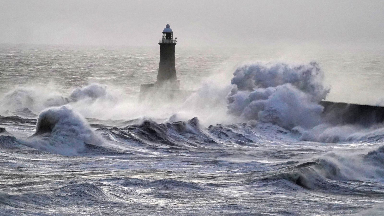
Residents in coastal towns were urged to stay clear of promenades and sea walls as large waves and storm surges were expected during high tide. Authorities warned that overtopping waves could pose serious risks to pedestrians and vehicles near exposed coastlines.
Schools in a small number of affected areas announced temporary closures or early dismissals, citing safety concerns related to travel conditions. Parents were advised to stay informed through local announcements as weather conditions evolved.
Despite the challenging conditions, emergency responders emphasized that early warnings and public cooperation were helping reduce risks. Fire and rescue services reported responding primarily to weather-related incidents, including fallen trees, minor flooding, and precautionary evacuations in isolated cases.
Weather officials indicated that Storm Chandra is expected to gradually weaken as it moves eastward overnight, though lingering rain and strong winds could continue into Tuesday morning. Authorities cautioned that flood risks may persist even after the storm passes, especially where ground conditions are already saturated.
The storm serves as another reminder of the increasing frequency of extreme weather events across the UK, with officials encouraging communities to remain prepared and responsive during severe conditions.